1
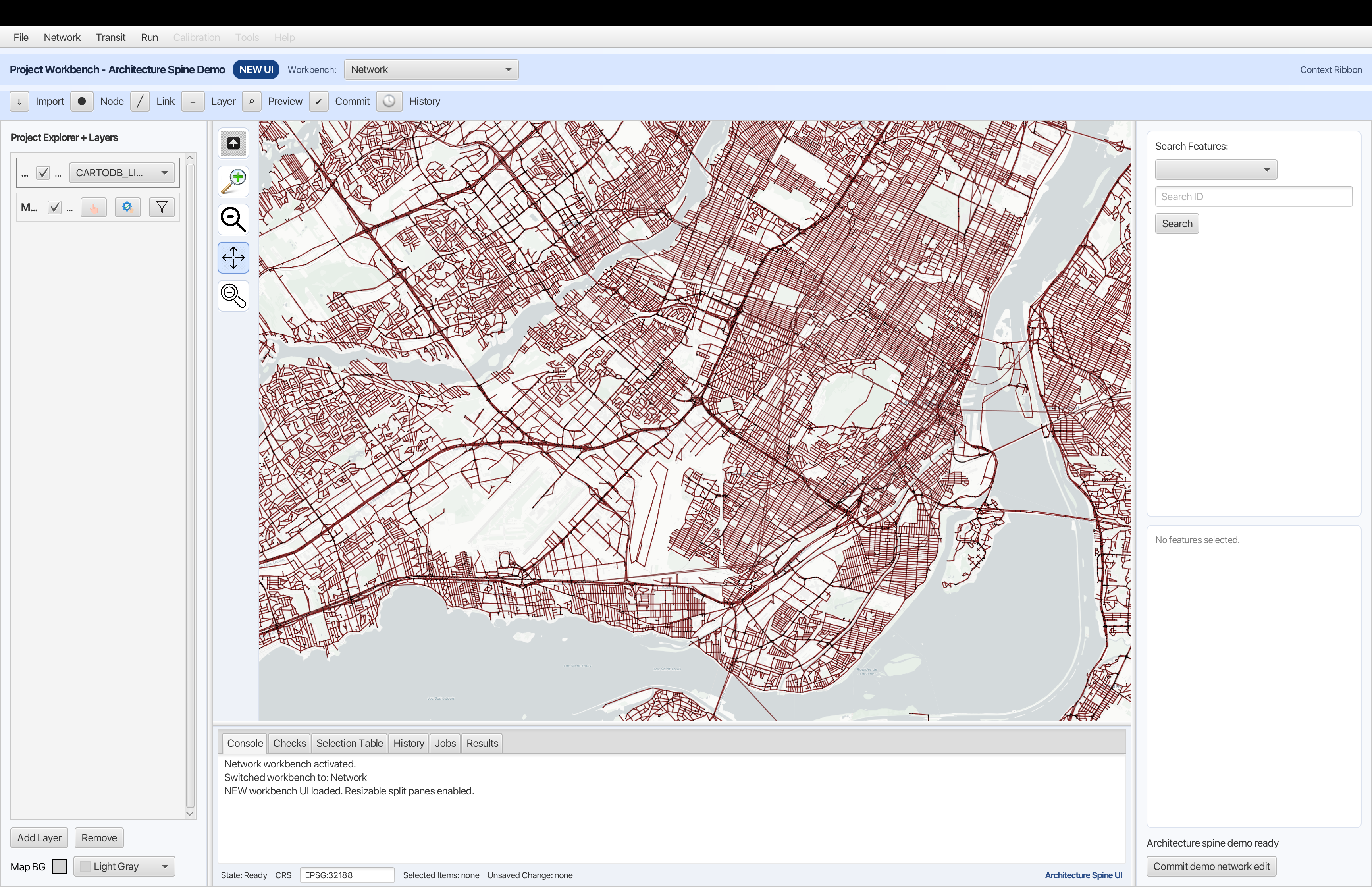
Edit & Validate
Adjust networks, transit lines, and facilities on an interactive map. Built-in checks catch topology errors before they propagate.
Built on MATSim
CityModeler gives transportation teams a visual workspace for scenario editing, simulation, and result analysis — without sacrificing technical rigor.
Built for agencies. Trusted by consultants. Adaptable for research.
Visual scenario editing
Audit-ready change history
Reproducible model runs
Offline-first desktop app
Three connected phases. One workspace. No tool-hopping.
Adjust networks, transit lines, and facilities on an interactive map. Built-in checks catch topology errors before they propagate.
Launch simulations, monitor progress, and compare baseline and alternative scenarios side by side.
Visualize results on the map, generate shareable reports, and export review-ready evidence for decision meetings.
Everything your team needs from scenario creation to evidence delivery.
Edit links, nodes, and lanes directly on layered maps. No XML hand-editing.
Control visibility and styling across basemaps and modeling layers.
Use focused views for network, transit, facilities, and model runs.
Every edit is timestamped and attributed. Export the full history for review meetings.
Branch alternatives, compare outputs, and protect baseline scenarios from accidental overwrite.
Assess likely effects before applying edits to production scenarios.
Surface topology and data issues early with workflow-integrated validation.
Start runs, monitor status, and keep execution context in view.
Explore scenario outputs with map-based and dashboard-ready visual summaries.
Compare baseline and alternatives side by side to quantify tradeoffs.
Generate shareable analysis reports for technical review and decision meetings.
One platform tuned for public planning, client delivery, and research rigor.
Support policy and capital decisions with transparent assumptions and review-ready records.
Deliver alternatives faster while maintaining a clear audit trail for clients.
Run reproducible experiments and share method-consistent scenarios across teams.
A proven transport modeling stack delivered in a stable cross-platform desktop app.
Compatible with established MATSim scenario and simulation workflows.
GIS-native rendering with strong spatial interoperability.
Native support for Windows, macOS, and Linux teams.
Share your modeling context, and we will prioritize onboarding for the best workflow fit.